Hiking Near Prague — 7 Trails You Can Reach by Public Transport

Prague sits in a river valley surrounded by forested hills, rocky gorges and nature reserves. You can leave your hotel after breakfast, ride a tram or metro to a trailhead, spend four hours walking through genuine wilderness, and be back in Old Town for a late lunch. No car rental, no tour bus, no planning headaches.
The Czech Republic has one of the best-marked trail systems in Europe — coloured blazes on trees and posts that guide you reliably through even remote terrain. These seven hikes are all reachable by Prague's public transport network. Each one offers something the city streets cannot: silence, elevation, and a completely different view of the landscape.
1. Divoká Šárka
Distance: 5 to 7 km loop | Difficulty: Easy to moderate | Time: 2 to 3 hours How to get there: Tram 20 or 26 to Divoká Šárka terminus (25 minutes from city centre)
Divoká Šárka is a rocky gorge on Prague's western edge that feels genuinely wild — sheer rock walls, a stream running through the valley floor, and old-growth forest on the slopes. The name means "Wild Šárka," after a mythological warrior woman, and the landscape earns it.
The trail starts at the tram terminus and follows the valley downstream. You pass a natural swimming pool (crowded in summer, peaceful otherwise), cross beneath sandstone cliffs, and emerge at the Jenerálka meadows at the far end. The loop back follows the ridge with views into the gorge below.
Insider detail: In early morning, before the swimmers arrive, the gorge is almost silent except for water and birdsong. The section between the swimming pool and the Džbán reservoir — roughly the middle third of the valley — is the wildest stretch, with cliff faces rising 30 metres on both sides.
2. Prokopské Údolí
Distance: 5 km one-way | Difficulty: Easy | Time: 1.5 to 2 hours How to get there: Metro B to Nové Butovice, then walk 10 minutes south
Prokopské údolí (Prokop Valley) is a limestone gorge in Prague's southwest. The geological interest is exceptional — Devonian-era limestone exposed in cliff faces dating back 400 million years, with visible fossil layers. The valley was quarried in the 19th century, and the abandoned quarries have become habitats for rare thermophilic plants and reptiles.
The trail follows the valley bottom from Nové Butovice toward Hlubočepy, with an optional detour to the Butovice Fortress — a prehistoric hillfort site with panoramic views.
Insider detail: Look for the Barrandov Cliffs (Barrandovské skály) at the downstream end of the valley. Named after Joachim Barrande, the French palaeontologist who studied Prague's Devonian fossils in the 19th century, these limestone faces contain trilobite fossils visible to the naked eye in certain sections.
3. Kunratický Les to Průhonice Park
Distance: 8 km one-way | Difficulty: Easy | Time: 2.5 to 3 hours How to get there: Metro C to Roztyly, then walk east into the forest
Kunratický les (Kunratice Forest) is Prague's largest contiguous woodland — a beech and oak forest in the city's southern suburbs. The trail from Roztyly metro leads through the forest, past a small lake, and onward to Průhonice Park — a UNESCO-listed landscape garden surrounding a Neo-Renaissance château.
Průhonice Park is a masterpiece of 19th-century garden design — 250 hectares of mature trees, ponds, streams and flowering meadows. The rhododendron collection blooms in May and June and is one of the largest in Central Europe. The park is free to enter and maintained by the Czech Academy of Sciences.
Insider detail: The transition from urban forest to designed landscape is gradual — you don't realize you've entered Průhonice Park until the path suddenly becomes gravel, the trees become labelled, and a perfectly placed bench appears overlooking a pond. The effect is intentional. The park was designed to blend into the surrounding forest.
4. Modřanská Rokle to Šance
Distance: 6 km one-way | Difficulty: Moderate | Time: 2 to 2.5 hours How to get there: Tram 17 or 21 to Nádraží Modřany, then walk south
Modřanská rokle (Modřany Gorge) cuts through the forested plateau south of Prague along a small stream. The trail follows the streambed uphill through a narrow, shaded valley — moss-covered boulders, exposed roots and the sound of water throughout. At the upper end, the path climbs to the Šance viewpoint overlooking the Vltava valley.
This trail is quieter than Divoká Šárka and more rugged. The path surface is natural — earth, roots, rock — and there are a few short steep sections. It suits hikers who want to feel like they've left the city entirely.
5. Říčanský Les and Říčany Fortress
Distance: 10 km loop | Difficulty: Moderate | Time: 3 to 4 hours How to get there: Train from Praha hlavní nádraží to Říčany (20 minutes, S-bahn line S1)
Říčany is a small town on Prague's southeastern edge with a ruined medieval fortress and extensive surrounding forests. The loop trail takes you from the train station through the fortress ruins, into the Říčanský les (Říčany Forest) — a mixed woodland with marked paths — and back through the countryside.
The fortress dates to the 13th century and preserves a substantial tower and wall sections. The surrounding forest is criss-crossed with trails of varying difficulty, and you can extend or shorten the route as stamina dictates.
Insider detail: The Říčany area has several studánky (natural springs) along the trail, marked on local maps. Czechs have a tradition of seeking out forest springs — some are maintained with wooden shelters and drainage channels. The water is cold, clear and generally safe, though most visitors stick to their own bottles.
Planning your visit? A private guide takes the logistics off your plate.
6. Karlštejn to Svatý Jan pod Skalou
Distance: 10 km one-way | Difficulty: Moderate | Time: 3 to 4 hours How to get there: Train from Praha hlavní nádraží to Karlštejn (40 minutes)
This trail connects two of Central Bohemia's most atmospheric destinations. Start at Karlštejn (optionally visit the castle first — see our Karlštejn Castle day trip), then follow the blue-blazed trail south through the Český kras (Bohemian Karst) — a limestone landscape of cliffs, caves and dry valleys.
The trail passes through mixed forest, descends into the Údolí Kačáku (Kačák Valley) and arrives at Svatý Jan pod Skalou — a small village beneath a massive cliff face, home to a Baroque monastery built into the rock. The monastery church houses what's claimed to be the oldest Christian chapel in Bohemia.
Insider detail: The cliff above Svatý Jan pod Skalou has a cave halfway up that's accessible by a steep path. From there, the view down to the monastery roof and the valley is remarkable. The cave was reportedly used as a hermitage by Ivan, the Czech patron saint after whom the village is named.
7. Sázava Valley from Čerčany
Distance: 8 to 12 km (flexible) | Difficulty: Easy to moderate | Time: 3 to 4 hours How to get there: Train from Praha hlavní nádraží to Čerčany (45 minutes)
The Sázava River south of Prague cuts through a forested valley that has attracted painters, writers and weekend hikers for over a century. The trail from Čerčany follows the river downstream through oak and pine forest, passing swimming spots, sandstone outcrops and the remains of old river mills.
The path is generally flat (it follows the river) with occasional short climbs to viewpoints above the valley. You can walk as far as energy allows and catch a train back from any of several stations along the river (Čerčany, Kamenný Přívoz, Jílové u Prahy, Davle). This flexibility makes it one of the most forgiving hikes on this list.
Trail Tips
Blazes: Czech trails are marked with coloured stripes painted on trees and posts — red (long-distance), blue, green and yellow (regional). Follow one colour consistently and you won't get lost.
Footwear: Solid walking shoes with ankle support are recommended for all trails except the flat Kunratický Les path. Most trails have natural surfaces — roots, rocks, earth — that are slippery when wet.
Water: Carry at least one litre. Some trails have natural springs or restaurants at endpoints, but most of the route is forest with no services.
Apps: The Mapy.cz app (Czech-made) has the most accurate trail maps, including all marked paths. Download the offline map for the Prague region before setting out.
After a day on the trails, return to Prague and experience the city from a different angle. Our All Prague in One Day tour covers the urban highlights with a private guide, and the Medieval Dinner Show is the ideal way to refuel after a day of hiking — unlimited food and mead in a 15th-century cellar.
Browse all our tours. Just your group, no strangers.
Frequently Asked Questions
Can you hike from Prague without a car?
Absolutely. Prague's public transport network — metro, trams and suburban trains — reaches trailheads for excellent hikes. All seven trails in this guide are accessible by public transport, with journeys ranging from 20 to 45 minutes from the city centre.
What is the best hike near Prague?
Divoka Sarka is the most dramatic for its rocky gorge landscape. Karlstejn to Svaty Jan pod Skalou is the most rewarding for distance walkers. Prokopske udoli is the best for geology. The choice depends on what you enjoy.
Are Prague hiking trails well marked?
Exceptionally. The Czech trail marking system uses coloured blazes (red, blue, green, yellow) painted on trees, rocks and posts. The system has been in place since the 19th century and is maintained by the Czech Tourist Club. Get lost is genuinely difficult if you follow the blazes.
When is the best season for hiking near Prague?
April through October. Spring brings wildflowers and birdsong. Summer is warmest but some trails can be crowded on weekends. Autumn offers the best colours, especially in the beech forests of Kunraticky les and Sazava valley.
You May Also Like
Want to see Prague for yourself?
Take our flagship Prague tour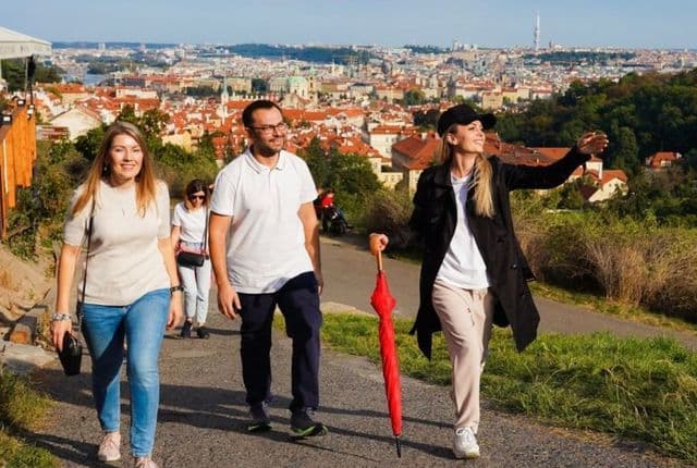

-6-640x430.jpg&w=3840&q=75)


